
Try searching for
Iconic drive · British Columbia
Pacific Rim Highway
The road across Vancouver Island to Canada's Pacific edge.
Overview
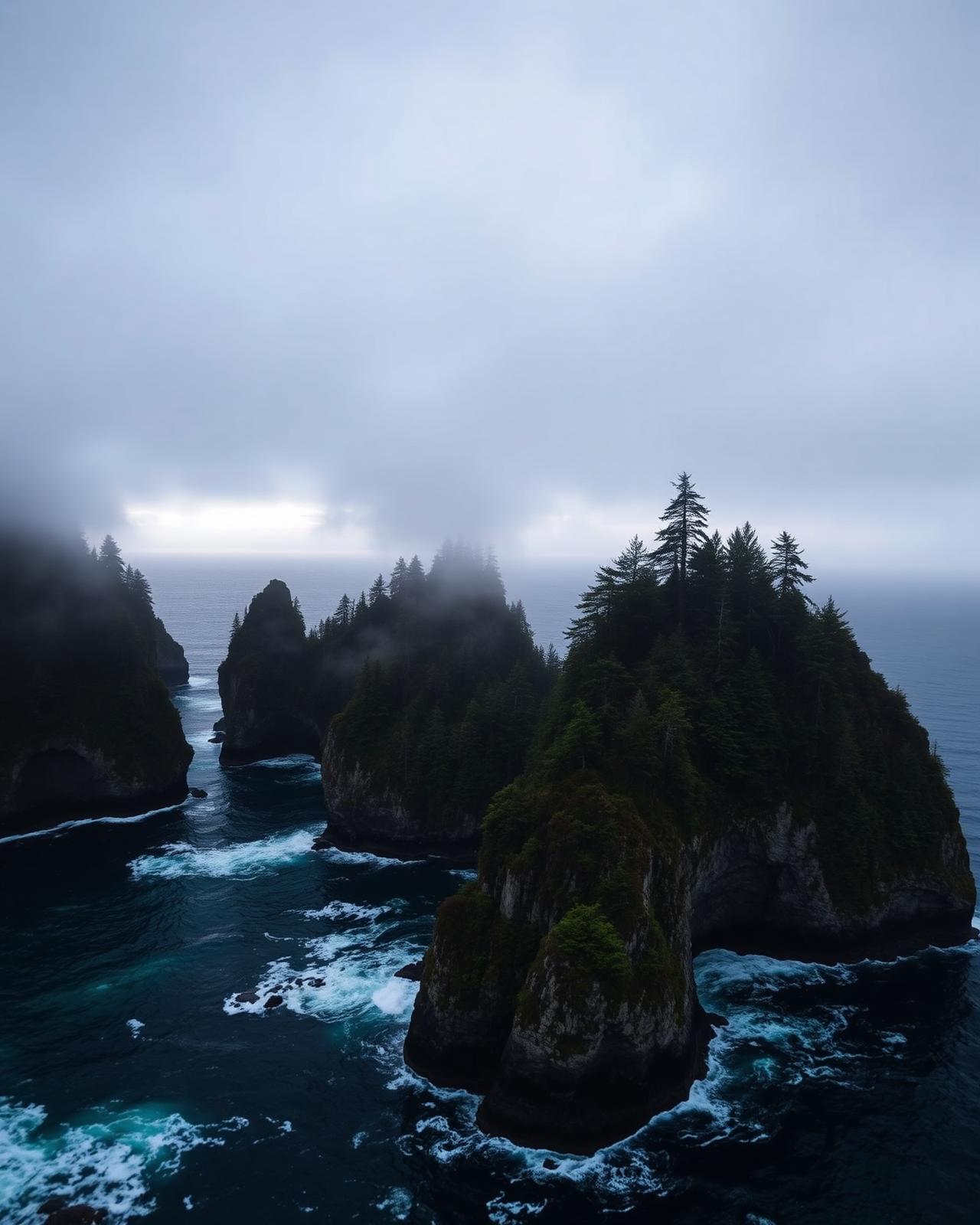
Route 4 — the Pacific Rim Highway — is the mountain crossing that connects Vancouver Island's calm east coast with the storm-forged west. In 165 km it climbs the Beaufort Range, threads Sutton Pass, and drops through Cathedral Grove's 800-year-old Douglas firs to the surf beaches of Long Beach.
The eastern anchor is Parksville, then the highway climbs west through Coombs (goats-on-the-roof country store) and MacMillan Provincial Park's Cathedral Grove — a free roadside stand of ancient Douglas firs. Port Alberni marks the halfway point at the head of a long inlet where the MV Frances Barkley still runs supply routes to Bamfield and the Broken Group Islands.
West of Sutton Pass the road descends into the Pacific Rim National Park Reserve. Ucluelet sits on the calmer south side; Tofino on the wild north. Long Beach — 16 km of open Pacific sand — is the surf-and-storm capital of Canada. Time it right and the same beach delivers a summer sunset and a winter tempest.
Distance
165 km
Parksville → Tofino
Highway
Route 4
Two-lane mountain highway
Park pass
Required
Pacific Rim National Park Reserve
Storm season
Nov–Feb
Wickaninnish storm-watching
The route
From start to finish
An approximate path through 5 key waypoints along the drive.
Driving times
Leg by leg
225 km across 3 legs. Times exclude stops, ferries, and weather contingencies.
| # | From → To | Distance | Driving time | Notes |
|---|---|---|---|---|
| 01 | Parksville → Port Alberni | 85 km | 1h 15m | Cathedral Grove stop |
| 02 | Port Alberni → Ucluelet | 100 km | 1h 45m | Sutton Pass |
| 03 | Ucluelet → Tofino | 40 km | 0h 45m | Long Beach corridor |
| Total | 225 km | 3h+ | Drive time only |
Day by day
The itinerary
A suggested route designed to balance driving time with the stops that matter.
Parksville to Port Alberni
Stop at Coombs and Cathedral Grove; overnight at the Hospitality Inn Port Alberni or a Sproat Lake cabin.
Port Alberni to Tofino
Cross Sutton Pass, visit the Kennedy Lake pull-off, and arrive in Tofino for a Long Beach sunset.
Tofino & the Reserve
Rainforest Trail, Wickaninnish Beach, and a Meares Island boat tour before returning east.
When to drive
Month by month
Best window: May – October (storm-watching Nov–Feb). Plan around shoulder months for fewer crowds at the cost of variable weather.
Budget
Three ways to drive it
Smart
$220–$330/ day
- Drive days
- 3
- Lodging
- PP camping, HI hostels
- Food
- Food trucks + fish markets
- Experiences
- Free beach hikes
Mid
$420–$680/ day
- Drive days
- 3
- Lodging
- Long Beach Lodge, Pacific Sands
- Food
- Wolf in the Fog, Shelter
- Experiences
- Surf lesson + Hot Springs boat
Premium
$1,200+/ day
- Drive days
- 3–4
- Lodging
- Wickaninnish Inn
- Food
- Pointe Restaurant tasting
- Experiences
- Private surf + storm-watching cabana
Editorial picks
Where to stop, sleep, and eat
Lodging
Wickaninnish Inn
Tofino
Relais & Châteaux cliff-top lodge — the birthplace of storm-watching.
Stop
Cathedral Grove
MacMillan PP
Free roadside stop under 800-year-old Douglas firs.
Operator
Tofino Resort + Marina
Tofino
Small-boat launch for Hot Springs Cove and Meares Island trips.
Eat
Wolf in the Fog
Tofino
James Beard-nominated PNW dining, the definitive Tofino dinner.
Signature stops
Don't miss
Cathedral Grove
Long Beach
Pacific Rim National Park Reserve
Wickaninnish Beach
Before you go
The prep checklist.
Practical things to lock in before you leave the driveway.
- Reserve Tofino accommodations 3–6 months ahead in summer.
- Drive Route 4 in daylight — Sutton Pass is tight.
- Pacific Rim NP parking passes required at Long Beach and Rainforest Trail.
- Book storm-watching packages Nov–Feb for cliff-facing rooms.
- Check DriveBC before departing; winter storms close the highway periodically.
Where this road leads
Related destinations
Good to know
Frequently
asked.
Practical answers from travellers who have driven this route.
- Is Route 4 dangerous?
- It is a mountain highway with tight bends, especially at Sutton Pass and Hydro Hill. Drive it in daylight and check DriveBC for closures — winter storms and rockfalls do close the road periodically.
- Do I need a park pass?
- Yes — Pacific Rim National Park Reserve requires a Parks Canada pass for beach parking and Rainforest Trails. Buy online to skip the visitor centre queue.
- Best time for storm-watching?
- November through February. Wickaninnish Inn and Long Beach Lodge run dedicated storm-watching packages with cliff-facing rooms and rain gear.
Planning the bigger trip?
Read our full guide to Canadian road-trip itineraries.
Along this route
Parks, camps, and cities on the drive
Every place below is within a comfortable side-trip of the route waypoints — surfaced automatically from our national-park, provincial-park, campground, and city datasets.
Nearby national parks
Nearby provincial parks
Nearby campgrounds
Travel styles
Related experiences
Adventure
Glacier hikes, sea kayaking, and heli-skiing across two oceans and three mountain ranges.
Explore →Luxury
Fairmont castles, wilderness lodges, and tasting menus framed by mountains and sea.
Explore →Family Travel
Wildlife safaris, island ferries, and lodges designed for shared discovery.
Explore →Food & Drink
Niagara wines, Atlantic lobster suppers, Montréal bagels, and Pacific oysters.
Explore →Plan smarter
Related travel guides
Getting Around · 8 min
Getting Around Canada
Flights, trains, road trips, and ferries — how to cross the world's second-largest country.
Read guide →Planning & Permits · 6 min
National & Provincial Parks Pass Guide
How to use the Discovery Pass, when to book ahead, and the lesser-known parks that rival Banff without the crowds.
Read guide →What to Pack · 6 min
Packing by Season
A season-by-season packing list for a country that swings from -40°C in February to +35°C in July.
Read guide →Money & Budget · 5 min
Money, Tipping & Daily Costs
How much to budget per day, how tipping really works, and where to get the best exchange rate.
Read guide →Keep exploring
Other road trips
British Columbia
Sea-to-Sky Highway
Vancouver to Whistler along the Howe Sound fjord — waterfalls, granite walls, and ocean on one side.
Explore →British Columbia & Alberta
Crowsnest Highway
Hope to Medicine Hat along Highway 3 — through the Okanagan, the Kootenays, and the Crowsnest Pass.
Explore →British Columbia
Vancouver Island Circle
Victoria to Port Hardy via Tofino — a full loop of the Pacific coast, old-growth forests, and orca waters.
Explore →British Columbia & Yukon
Alaska Highway (Canadian section)
Dawson Creek to the Alaska border via Fort Nelson, Muncho Lake, Liard Hot Springs, and Whitehorse — bison, hot springs, and the Signpost Forest.
Explore →Ready to go?
Plan this road trip with us.
Tell us when you'd like to travel and what you're hoping to experience. A Canadian trip designer will reply within one business day with a custom itinerary built around "Pacific Rim Highway" — no obligation, no pressure.
Free consultation · Reply within 1 business day