Try searching for
Scenic Loop drive · British Columbia & Alberta
Crowsnest Highway
The quieter southern alternative to the Trans-Canada — Rockies, wineries, and ghost towns.
Overview
Highway 3, the Crowsnest, is the southern alternative to the Trans-Canada — and many seasoned travellers swear it is the better drive. From Hope in British Columbia's Fraser Valley, it climbs over Allison Pass into the Okanagan wine country, traces the Kootenay Rockies through Nelson and Fernie, then crests the Crowsnest Pass into Alberta and the prairie.
The Crowsnest takes longer than the Trans-Canada — that is the point. Stops include Manning Park's alpine meadows, the orchards and wineries of the Similkameen and South Okanagan (Osoyoos is the warmest place in Canada), Nelson's Kootenay Lake heritage town, Fernie's powder skiing in winter, and the haunting Frank Slide, where a 1903 rockslide buried a coal-mining town in 90 seconds.
Beyond Pincher Creek, the highway drops onto the Alberta prairie and rolls east through Lethbridge to Medicine Hat. It is the lesser-known route, with fewer big-rig trucks, more lookouts, and the kind of small Canadian towns the Trans-Canada bypasses entirely.
Distance
1,160 km
Hope → Medicine Hat
Mountain passes
5
Allison, Anarchist, Salmo–Creston, Kootenay, Crowsnest
Highest point
1,396 m
Crowsnest Pass
Free ferry
Kootenay Lake
Longest free ferry on Earth
The route
From start to finish
An approximate path through 6 key waypoints along the drive.
Driving times
Leg by leg
1330 km across 6 legs. Times exclude stops, ferries, and weather contingencies.
| # | From → To | Distance | Driving time | Notes |
|---|---|---|---|---|
| 01 | Hope → Princeton | 135 km | 1h 45m | Allison Pass + Manning Park |
| 02 | Princeton → Osoyoos | 175 km | 2h 15m | Similkameen wineries |
| 03 | Osoyoos → Nelson | 320 km | 4h 00m | Anarchist Mt switchbacks |
| 04 | Nelson → Fernie | 300 km | 3h 45m | Kootenay Lake free ferry |
| 05 | Fernie → Pincher Creek | 130 km | 1h 30m | Crowsnest Pass + Frank Slide |
| 06 | Pincher Creek → Medicine Hat | 270 km | 3h 00m | Prairie roll-out |
| Total | 1330 km | 16h+ | Drive time only |
Day by day
The itinerary
A suggested route designed to balance driving time with the stops that matter.
Hope to Princeton
Climb out of the Fraser Valley over Allison Pass through Manning Provincial Park, with stops at Cascade Lookout and Lightning Lake.
Princeton to Osoyoos
Drop into the Similkameen Valley, taste at the small-batch wineries, and overnight on the warm shore of Osoyoos Lake.
Osoyoos to Nelson
Drive the Kootenay River corridor through Castlegar, then climb into Nelson's heritage downtown for a two-night base.
Nelson & Kootenay Lake
Take the free ferry across Kootenay Lake (the longest free ferry ride in the world), tour Ainsworth Hot Springs, and return for dinner in Nelson.
Nelson to Fernie
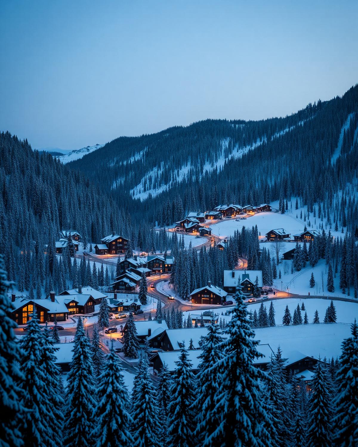
Continue east through Creston, climb the Salmo–Creston Pass, and arrive in Fernie for mountain views and craft beer.
Fernie to Pincher Creek
Cross the Crowsnest Pass, stop at the Frank Slide interpretive centre, and overnight in Pincher Creek at the gateway to Waterton.
Pincher Creek to Medicine Hat
Roll east across the southern Alberta prairie, with optional detours to Waterton Lakes National Park or Head-Smashed-In Buffalo Jump UNESCO site.
When to drive
Month by month
Best window: May – October. Plan around shoulder months for fewer crowds at the cost of variable weather.
Budget
Three ways to drive it
Smart
$200–$320/ day
- Drive days
- 6–7
- Lodging
- Provincial parks, motels
- Food
- Diners + winery picnics
- Experiences
- Free passes + Frank Slide centre
Mid
$360–$580/ day
- Drive days
- 7
- Lodging
- Hume Hotel Nelson, Lizard Creek Lodge Fernie
- Food
- Pitchfork, Big Bang Bagel
- Experiences
- Wine tasting + Ainsworth Hot Springs
Premium
$800+/ day
- Drive days
- 8
- Lodging
- Spirit Ridge Osoyoos, Island Lake Lodge
- Food
- Miradoro at Tinhorn, Cedar House Fernie
- Experiences
- Helicopter wine tour + cat-skiing day
Editorial picks
Where to stop, sleep, and eat
Stop
Kootenay Lake free ferry
Balfour → Kootenay Bay
35-minute crossing on the world's longest free ferry — sailings every 1–2 hours.
Lodging
Hume Hotel
Nelson
1898 heritage hotel on Baker Street, walking distance to all of Nelson's restaurants.
Operator
Frank Slide Interpretive Centre
Crowsnest Pass
Multi-media reckoning with the 1903 rockslide — the most powerful stop on the highway.
Eat
Miradoro at Tinhorn Creek
Oliver
Cliff-top winery patio above the South Okanagan vines.
Signature stops
Don't miss
Manning Provincial Park
Osoyoos wineries
Nelson heritage downtown
Frank Slide interpretive centre
Before you go
The prep checklist.
Practical things to lock in before you leave the driveway.
- Winter tires legally required Oct 1 – Apr 30 on all five passes.
- Add 90 minutes for the Kootenay Lake ferry (queue + crossing).
- Detour to Waterton Lakes NP from Pincher Creek — 2 extra nights minimum.
- Many Okanagan wineries close 5 pm — plan tastings before dinner.
- Fill up in Castlegar before the Salmo–Creston pass.
Where this road leads
Related destinations
Good to know
Frequently
asked.
Practical answers from travellers who have driven this route.
- How is the Crowsnest different from the Trans-Canada?
- It is roughly 200 km longer between Vancouver and Calgary, with more mountain passes and slower speed limits. The trade-off is far less truck traffic, more scenic variety, and access to the Okanagan wine country and the Kootenays.
- Can I drive the Crowsnest in winter?
- Yes, but several passes (Allison, Salmo–Creston, Crowsnest) get heavy snow. Winter tires are mandatory October 1 to April 30 on BC mountain highways, and chains are recommended in storm conditions.
- Where should I add a detour for Waterton Lakes?
- From Pincher Creek, Waterton Lakes National Park is a 50-km southern detour and one of the most underrated parks in Canada. Add two nights to do it justice.
Planning the bigger trip?
Read our full guide to Canadian road-trip itineraries.
Along this route
Parks, camps, and cities on the drive
Every place below is within a comfortable side-trip of the route waypoints — surfaced automatically from our national-park, provincial-park, campground, and city datasets.
Nearby national parks
Nearby provincial parks
Travel styles
Related experiences
Adventure
Glacier hikes, sea kayaking, and heli-skiing across two oceans and three mountain ranges.
Explore →Luxury
Fairmont castles, wilderness lodges, and tasting menus framed by mountains and sea.
Explore →Family Travel
Wildlife safaris, island ferries, and lodges designed for shared discovery.
Explore →Food & Drink
Niagara wines, Atlantic lobster suppers, Montréal bagels, and Pacific oysters.
Explore →Plan smarter
Related travel guides
Getting Around · 8 min
Getting Around Canada
Flights, trains, road trips, and ferries — how to cross the world's second-largest country.
Read guide →Planning & Permits · 6 min
National & Provincial Parks Pass Guide
How to use the Discovery Pass, when to book ahead, and the lesser-known parks that rival Banff without the crowds.
Read guide →What to Pack · 6 min
Packing by Season
A season-by-season packing list for a country that swings from -40°C in February to +35°C in July.
Read guide →Money & Budget · 5 min
Money, Tipping & Daily Costs
How much to budget per day, how tipping really works, and where to get the best exchange rate.
Read guide →Keep exploring
Other road trips
Alberta
Cowboy Trail (Highway 22)
Waterton Lakes to Mayerthorpe along Highway 22 — cattle country, foothills panoramas, and rodeo towns.
Explore →British Columbia
Pacific Rim Highway
Parksville to Tofino on Route 4 — Cathedral Grove, surf beaches, and the Pacific Rim National Park Reserve.
Explore →Alberta
Icefields Parkway
Lake Louise to Jasper through a corridor of glaciers, turquoise lakes, and roadside grizzlies.
Explore →British Columbia
Sea-to-Sky Highway
Vancouver to Whistler along the Howe Sound fjord — waterfalls, granite walls, and ocean on one side.
Explore →Ready to go?
Plan this road trip with us.
Tell us when you'd like to travel and what you're hoping to experience. A Canadian trip designer will reply within one business day with a custom itinerary built around "Crowsnest Highway" — no obligation, no pressure.
Free consultation · Reply within 1 business day