
Try searching for
Wilderness drive · Ontario
Lake Superior Circle Tour
The wild north shore of the world's largest freshwater lake.
Overview
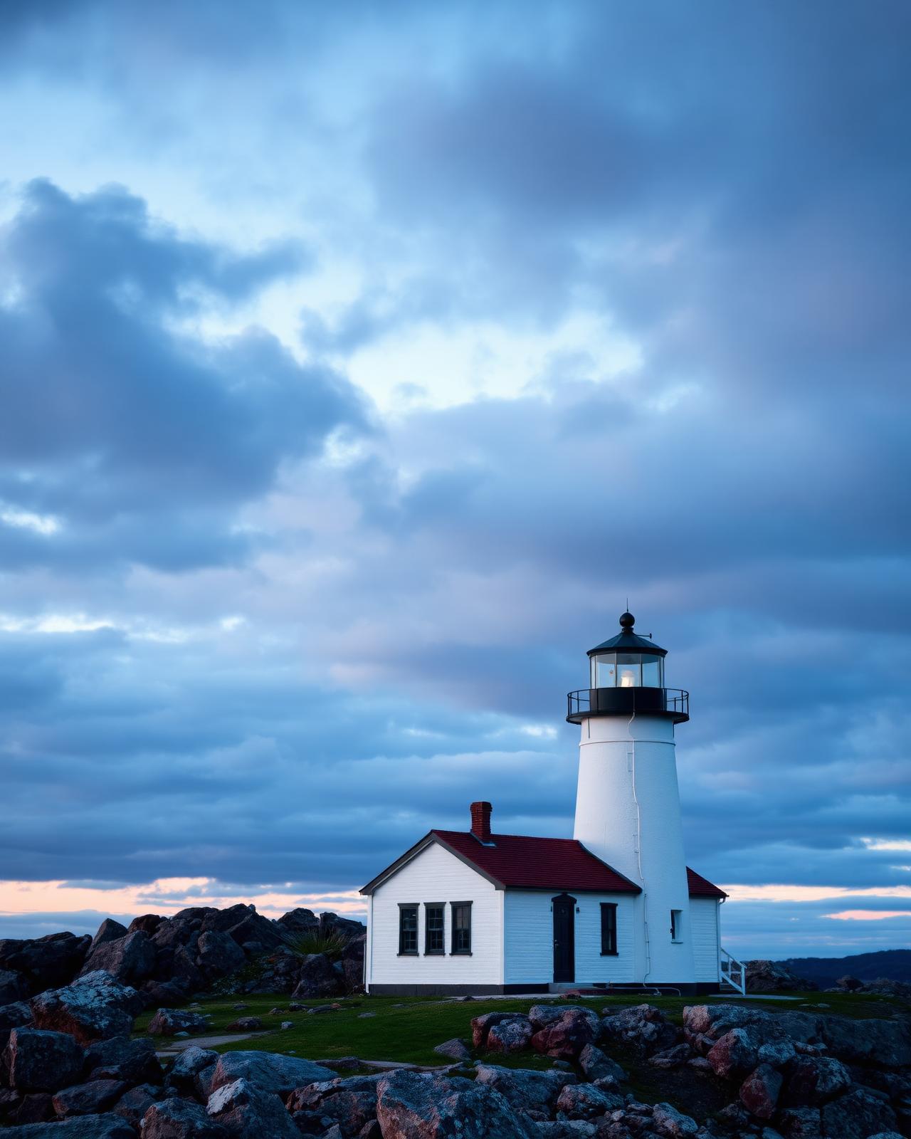
The Ontario stretch of the Lake Superior Circle is Canada's great wilderness drive south of the Arctic. Highway 17 traces 710 km of granite headlands, boreal forest, and freshwater beaches on the north shore of a lake so large it holds one-tenth of the world's fresh water.
The drive begins in Sault Ste. Marie at the international bridge to Michigan and climbs immediately into Lake Superior Provincial Park — the landscape the Group of Seven made famous. Beyond, Wawa's giant goose statue and the ghost town of Michipicoten mark the transition to true wilderness. Pukaskwa National Park, midway along the shore, protects the largest undeveloped coastline on any Great Lake.
The final third of the route runs through Terrace Bay, Nipigon, and into Thunder Bay — the historic fur-trade capital at the head of the lake, with the Sleeping Giant peninsula filling the harbour view. Fuel is well-spaced but plan carefully: some stretches between towns exceed 100 km with no services.
Distance (ON)
710 km
Sault Ste. Marie → Thunder Bay
Full circle
2,100 km
Including US shore
National parks
1
Pukaskwa NP
Provincial parks
5+
Lake Superior, Neys, Sleeping Giant
The route
From start to finish
An approximate path through 6 key waypoints along the drive.
Driving times
Leg by leg
760 km across 4 legs. Times exclude stops, ferries, and weather contingencies.
| # | From → To | Distance | Driving time | Notes |
|---|---|---|---|---|
| 01 | Sault Ste. Marie → Wawa | 230 km | 3h 00m | Lake Superior PP |
| 02 | Wawa → Marathon | 220 km | 2h 45m | Pukaskwa NP access |
| 03 | Marathon → Terrace Bay | 90 km | 1h 10m | Neys PP + Aguasabon Falls |
| 04 | Terrace Bay → Thunder Bay | 220 km | 2h 45m | Nipigon River bridge |
| Total | 760 km | 9h+ | Drive time only |
Day by day
The itinerary
A suggested route designed to balance driving time with the stops that matter.
Sault Ste. Marie
Ride the Agawa Canyon Tour Train into the Group of Seven country; overnight downtown at the Delta Waterfront.
Lake Superior Provincial Park
Drive into the park, hike the Agawa Rock pictographs and Old Woman Bay; camp or lodge at Rock Island.
Wawa & Pukaskwa
Continue to Wawa (giant goose photo op), then push west to Pukaskwa National Park; hike the Southern Headland Trail.
Marathon to Terrace Bay
Beach day at Neys Provincial Park; sunset at Aguasabon Falls in Terrace Bay.
Terrace Bay to Thunder Bay
Cross the Nipigon River bridge, stop at Kama Bay lookout, and arrive in Thunder Bay for the Sleeping Giant view.
Thunder Bay & the Sleeping Giant
Day-trip into Sleeping Giant Provincial Park for the Top of the Giant hike, or visit Kakabeka Falls and Fort William Historical Park.
When to drive
Month by month
Best window: June – early October. Plan around shoulder months for fewer crowds at the cost of variable weather.
Budget
Three ways to drive it
Smart
$200–$310/ day
- Drive days
- 5–6
- Lodging
- Provincial park camping, Trans-Canada motels
- Food
- Diners + fish shacks
- Experiences
- Self-hike + free viewpoints
Mid
$360–$580/ day
- Drive days
- 6
- Lodging
- Rock Island Lodge Wawa, Prince Arthur Thunder Bay
- Food
- Wapiti Wawa, Bight Restaurant Thunder Bay
- Experiences
- Agawa Canyon train + Pukaskwa half-day
Premium
$800+/ day
- Drive days
- 6–7
- Lodging
- Delta Sault Ste. Marie waterfront + heritage inns
- Food
- Bight tasting menu
- Experiences
- Group of Seven guided tour + Sleeping Giant heli
Editorial picks
Where to stop, sleep, and eat
Operator
Agawa Canyon Tour Train
Sault Ste. Marie
One-day rail excursion into the Group of Seven's landscape — the Fall Colour season sells out months ahead.
Stop
Old Woman Bay
Lake Superior Provincial Park
Pull-off with a granite cliff face and a beach — one of the most photographed spots on the highway.
Lodging
Rock Island Lodge
Wawa
Waterfront lodge with kayak launches straight into the lake.
Eat
The Bight Restaurant
Thunder Bay
Sleeping Giant harbour view with Lake Superior fish and locally sourced everything.
Signature stops
Don't miss
Lake Superior Provincial Park
Agawa Canyon Tour Train
Pukaskwa National Park
Sleeping Giant Provincial Park
Before you go
The prep checklist.
Practical things to lock in before you leave the driveway.
- Book the Agawa Canyon Tour Train 2+ months ahead for peak fall colour weekends.
- Fuel up before long stretches — some gaps exceed 100 km with no services.
- Watch for moose on Highway 17, especially at dawn and dusk.
- Pukaskwa's Coastal Hiking Trail requires a full week; the Southern Headland day-hike is a great sample.
- Sleeping Giant weather is unpredictable — pack layers for the Top of the Giant hike.
Where this road leads
Related destinations
Good to know
Frequently
asked.
Practical answers from travellers who have driven this route.
- Is the road paved the whole way?
- Yes — Highway 17 is fully paved and part of the Trans-Canada Highway. It is a comfortable drive, but distances between services are long by southern Ontario standards.
- Can I do the full Superior Circle including the US side?
- Yes — the full circle continues through Michigan, Wisconsin, and Minnesota back to the border. Allow 12–14 days total; a passport is required for the US portion.
- When is the best time for fall colours?
- Late September through the first week of October is peak — the Group of Seven painted these forests for a reason. The Agawa Canyon Tour Train's Fall Colour season sells out months ahead.
Planning the bigger trip?
Read our full guide to Canadian road-trip itineraries.
Along this route
Parks, camps, and cities on the drive
Every place below is within a comfortable side-trip of the route waypoints — surfaced automatically from our national-park, provincial-park, campground, and city datasets.
Nearby national parks
Nearby provincial parks
Cities along the way
Travel styles
Related experiences
Family Travel
Wildlife safaris, island ferries, and lodges designed for shared discovery.
Explore →Food & Drink
Niagara wines, Atlantic lobster suppers, Montréal bagels, and Pacific oysters.
Explore →Cruises
Inside Passage glaciers, St. Lawrence whales, Great Lakes shorelines.
Explore →Rail Journeys
Iconic Rocky Mountaineer glass domes and VIA Rail's transcontinental Canadian.
Explore →Plan smarter
Related travel guides
Getting Around · 8 min
Getting Around Canada
Flights, trains, road trips, and ferries — how to cross the world's second-largest country.
Read guide →Planning & Permits · 6 min
National & Provincial Parks Pass Guide
How to use the Discovery Pass, when to book ahead, and the lesser-known parks that rival Banff without the crowds.
Read guide →What to Pack · 6 min
Packing by Season
A season-by-season packing list for a country that swings from -40°C in February to +35°C in July.
Read guide →Money & Budget · 5 min
Money, Tipping & Daily Costs
How much to budget per day, how tipping really works, and where to get the best exchange rate.
Read guide →Keep exploring
Other road trips
Ontario
Georgian Bay Coastal Route
Collingwood to Killarney via Tobermory and Parry Sound — the world's largest freshwater archipelago, painted by the Group of Seven.
Explore →Ontario
Ottawa Valley Route
Ottawa to Barry's Bay via Arnprior and Pembroke — the Ottawa River, Polish heritage villages, and the wild eastern approach to Algonquin.
Explore →Ontario
Thousand Islands Parkway
Gananoque to Brockville — the free scenic alternative to the 401 through Thousand Islands National Park.
Explore →Alberta
Icefields Parkway
Lake Louise to Jasper through a corridor of glaciers, turquoise lakes, and roadside grizzlies.
Explore →Time it right
Nearby events & festivals
Events along the Lake Superior Circle Tour route — worth timing your trip around.
Ready to go?
Plan this road trip with us.
Tell us when you'd like to travel and what you're hoping to experience. A Canadian trip designer will reply within one business day with a custom itinerary built around "Lake Superior Circle Tour" — no obligation, no pressure.
Free consultation · Reply within 1 business day