
Ontario Parks
Lake Superior Provincial Park
Ontario Est. 1944 1,550 km²
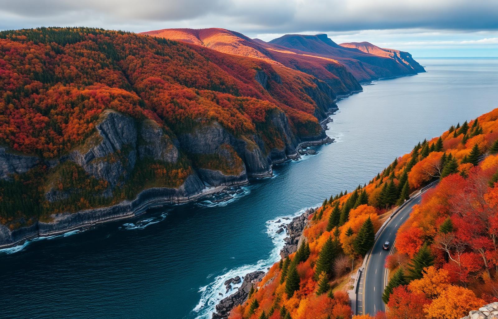
Ontario's most cinematic coastline — pink granite cliffs into an inland sea, painted by the Group of Seven.
Overview
Lake Superior Provincial Park stretches 100 km along the eastern shore of Lake Superior between Sault Ste. Marie and Wawa. Highway 17 hugs the coast the whole way, weaving through the same granite headlands that Lawren Harris and A.Y. Jackson painted. Agawa Rock's Anishinaabe pictographs are among the best-preserved in the country. Three car-camping loops and 120 backcountry sites cover a huge range of skill levels.
- 100 km of Lake Superior coastline in one park
- Agawa Rock pictographs — one of Canada's best-preserved rock-art sites
- Coastal Trail — the interior backpacker's classic
- Highway 17 drive-through views for road-trippers
Quick facts
- Size
- 1,550 km²
- Established
- 1944
- Coastline
- 100 km
- Coastal Trail
- 65 km
Things to do
Agawa Rock pictographs
Coastal Trail backpack
Old Woman Bay beach
Autumn Highway 17 drive
Camping
Reservations: Recommended · Frontcountry: Yes · Backcountry: Yes · RV: Yes · Glamping: No
- Agawa Bay, Rabbit Blanket Lake, Crescent Lake campgrounds
- 120 backcountry sites on Coastal Trail
- Backcountry paddle-in sites on interior lakes
Hiking
Coastal Trail
Hard · 65 km5-7 day backpack; rugged, wet, world-class views.
Agawa Rock Pictographs
Moderate · 0.5 kmShort scramble to the pictograph ledge — dangerous in high water.
Awausee Trail
Moderate · 10 kmRidge walk with panoramic Lake Superior views.
Old Woman Bay
Easy · 1 kmFamily beach walk with towering granite backdrop.
Wildlife
Common
Moose, Black bear, Beaver, Bald eagle
Signature
Timber wolf, Woodland caribou (rare), Peregrine falcon
Viewing tips
Moose on the Highway 17 corridor at dawn; wolves audible from Coastal Trail sites.
Safety
Coastal Trail is remote and rugged — carry a satellite messenger. Bear-safe food storage mandatory.
Photography
- Old Woman Bay at sunset
- Coastal Trail — Sinclair Cove pink granite
- Agawa Rock pictographs
- Autumn colour on Highway 17 (late Sept)
Best time to visit
spring
May-June: waterfalls at peak, black flies boom.
summer
Jul-Aug: prime hiking weather, warmest (still-cold) Lake Superior swim.
fall
Late Sept-early Oct: peak colour on Highway 17.
winter
Highway 17 open; park facilities closed.
Peak: Second half of September (colour) + July-August · Shoulder: June, October
Family & accessibility
Family
- Old Woman Bay beach
- Agawa Bay day-use area
- Junior Ranger interpretive programs
Accessibility
- Accessible sites at Agawa Bay and Rabbit Blanket Lake
- Paved viewpoints along Highway 17
Reservations
Book through Ontario Parks Reservation Service — opens 150 days ahead of arrival.
Reserve nowSuggested itineraries
3-day
Highway 17 Fall Drive
Two nights at Agawa Bay, one day at pictographs, one drive to Wawa with pull-outs.
canoe
Coastal Trail 5-Day
Sinclair Cove to Chalfant Cove — bring the dry bags.
FAQ
Can I drive to the pictographs?
You drive to the trailhead, then it's a short but steep scramble to the ledge.
Is Lake Superior swimmable?
In sheltered coves in August, sort of. Water rarely exceeds 15°C.
How hard is the Coastal Trail?
Hard — wet feet, rocky footing, no bailout points. Book 5-7 days minimum.
Nearby
National parks
- Pukaskwa National Park · 116 km
- Bruce Peninsula National Park · 361 km
- Georgian Bay Islands National Park · 487 km
Nearby cities
- Sault Ste. Marie · 125 km
- Thunder Bay · 342 km
- Algonquin · 542 km
Other provincial parks
- Killarney Provincial Park · 313 km
- Cyprus Lake (Bruce Peninsula) Provincial Camping · 363 km
- Grundy Lake Provincial Park · 374 km
- Awenda Provincial Park · 480 km
Road trips
Plan this trip with a human
Our Travel Concierge builds custom itineraries around Lake Superior Provincial Park — permits, campsites, driving times, and shoulder-season strategy included.
Talk to the Concierge