
Try searching for
Iconic drive · Alberta
Icefields Parkway
The most scenic drive in the world, according to almost everyone who's done it.
Overview
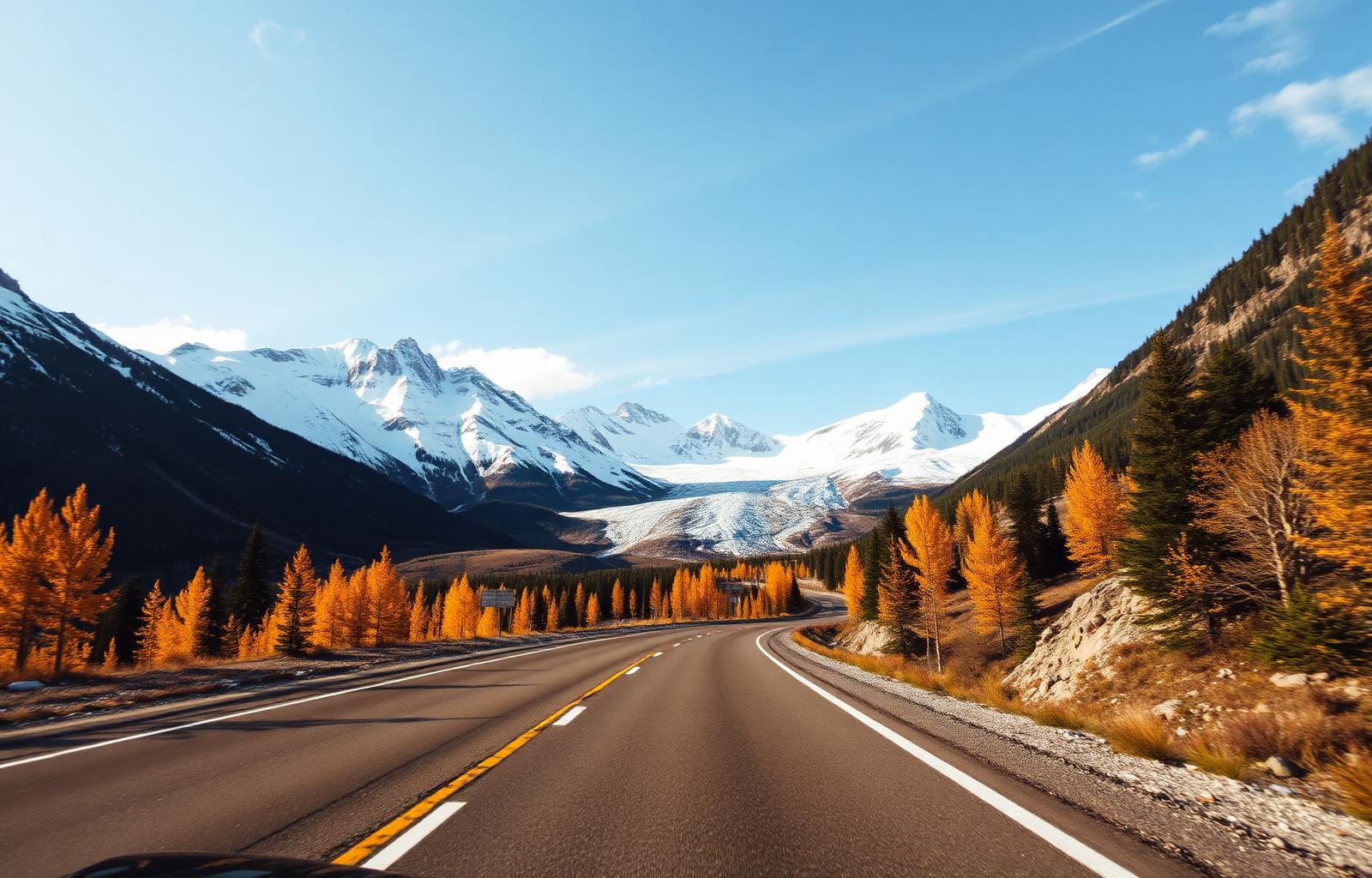
There are drives, and then there is the Icefields Parkway. For 232 kilometres, Highway 93 traces the Continental Divide through a landscape that feels borrowed from another planet — glaciers spilling from peaks, lakes of impossible blue, and wildlife that treats the roadside as its own.
Built during the Great Depression as a relief project, the parkway opened in 1940 and has since become the defining road-trip experience of the Canadian Rockies. Every kilometre is a postcard: Bow Lake mirrors Crowfoot Glacier at dawn, Peyto Lake's viewpoint delivers a wolf-head shape of turquoise, and the Athabasca Glacier lets you walk on ice older than recorded history.
Parks Canada advises at least two full days, but three is better — it gives you time for the hikes, the viewpoints, and the long silences that this landscape demands. Wildlife is abundant: elk, bighorn sheep, black bears, and the occasional grizzly. Early mornings and late evenings are the best times to spot them.
Distance
232 km
Lake Louise → Jasper
Highway
Hwy 93N
Two-lane paved
Highest point
2,088 m
Bow Summit
Park pass
Required
Banff + Jasper
The route
From start to finish
An approximate path through 6 key waypoints along the drive.
Driving times
Leg by leg
235 km across 6 legs. Times exclude stops, ferries, and weather contingencies.
| # | From → To | Distance | Driving time | Notes |
|---|---|---|---|---|
| 01 | Lake Louise → Bow Lake | 37 km | 0h 35m | Crowfoot Glacier viewpoint |
| 02 | Bow Lake → Peyto Lake | 5 km | 0h 10m | 10-min walk to overlook |
| 03 | Peyto Lake → Saskatchewan Crossing | 36 km | 0h 40m | Last fuel, often empty |
| 04 | Saskatchewan Crossing → Columbia Icefield | 52 km | 1h 00m | Big Bend switchback |
| 05 | Columbia Icefield → Athabasca Falls | 75 km | 1h 15m | Sunwapta Falls en route |
| 06 | Athabasca Falls → Jasper | 30 km | 0h 30m | Wapiti / elk zone |
| Total | 235 km | 4h+ | Drive time only |
Day by day
The itinerary
A suggested route designed to balance driving time with the stops that matter.
Lake Louise to Saskatchewan Crossing
Start at Lake Louise, detour to Moraine Lake at dawn, then follow the valley past Bow Lake, Peyto Lake, and Waterfowl Lakes before reaching the Crossing.
The Columbia Icefield
Drive onto the Athabasca Glacier with an Ice Explorer, walk the Skywalk, and hike to Wilcox Pass for a panoramic view of the icefield.
Athabasca Valley to Jasper
Cruise past Sunwapta and Athabasca Falls, scan for moose in the wetlands, and arrive in Jasper for a sunset at Pyramid Lake.
When to drive
Month by month
Best window: May – October. Plan around shoulder months for fewer crowds at the cost of variable weather.
Budget
Three ways to drive it
Smart
$220–$320/ day
- Drive days
- 3
- Lodging
- HI hostels, Wapiti campground
- Food
- Diners + groceries
- Experiences
- Self-guided hikes
Mid
$420–$650/ day
- Drive days
- 3–4
- Lodging
- Mount Royal, Pyramid Lake Lodge
- Food
- Bistros in Jasper
- Experiences
- Glacier Skywalk + boat tour
Premium
$1,100+/ day
- Drive days
- 4–5
- Lodging
- Fairmont Chateau Lake Louise, Jasper Park Lodge
- Food
- Walliser Stube, ORSO
- Experiences
- Heli-tour + private glacier guide
Editorial picks
Where to stop, sleep, and eat
Lodging
The Crossing Resort
Saskatchewan Crossing
Only mid-route bed; rooms book a year ahead in July.
Stop
Wilcox Pass trail
Columbia Icefield
Hike-up alternative to the Skywalk crowds — full glacier panorama in 90 min.
Operator
Pursuit — Columbia Icefield Adventure
Athabasca Glacier
Ice Explorer + Skywalk combo with timed tickets.
Eat
Bear's Paw Bakery
Jasper
Sourdough breakfast pre-drive, then drive south at first light.
Signature stops
Don't miss
Columbia Icefield
Peyto Lake viewpoint
Athabasca Falls
Lake Louise
Before you go
The prep checklist.
Practical things to lock in before you leave the driveway.
- Fill the tank in Lake Louise or Jasper — no fuel on the Parkway.
- Buy a Parks Canada Discovery Pass online to skip the gate queue.
- Download Parks Canada's offline map — cell coverage drops past Bow Summit.
- Carry bear spray for any hike over 1 km from the road.
- Pack layers: it can snow on Sunwapta Pass in July.
Where this road leads
Related destinations
Good to know
Frequently
asked.
Practical answers from travellers who have driven this route.
- Do I need a park pass to drive the Icefields Parkway?
- Yes — the entire route lies within Banff and Jasper National Parks. A Parks Canada Discovery Pass covers both parks and is valid for a full year.
- Is fuel available along the route?
- There are no gas stations on the parkway itself. Fill up in Lake Louise or Jasper before you start. Saskatchewan Crossing has limited fuel, but it is not guaranteed.
- When is the best time of day to drive?
- Early morning (6 – 9 am) and late evening (5 – 8 pm) offer the best light, fewer tour buses, and the highest chance of wildlife sightings.
Planning the bigger trip?
Read our full guide to Canadian road-trip itineraries.
Along this route
Parks, camps, and cities on the drive
Every place below is within a comfortable side-trip of the route waypoints — surfaced automatically from our national-park, provincial-park, campground, and city datasets.
Nearby national parks
Nearby provincial parks
Nearby campgrounds
Travel styles
Related experiences
Adventure
Glacier hikes, sea kayaking, and heli-skiing across two oceans and three mountain ranges.
Explore →Luxury
Fairmont castles, wilderness lodges, and tasting menus framed by mountains and sea.
Explore →Road Trips
Scenic highways from coast to coast — Icefields Parkway to the Cabot Trail.
Explore →Rail Journeys
Iconic Rocky Mountaineer glass domes and VIA Rail's transcontinental Canadian.
Explore →Plan smarter
Related travel guides
Getting Around · 8 min
Getting Around Canada
Flights, trains, road trips, and ferries — how to cross the world's second-largest country.
Read guide →Planning & Permits · 6 min
National & Provincial Parks Pass Guide
How to use the Discovery Pass, when to book ahead, and the lesser-known parks that rival Banff without the crowds.
Read guide →Getting Around · 7 min
Winter Driving in Canada
Snow tires, mountain passes, what to keep in your trunk, and when to stay off the highway entirely.
Read guide →What to Pack · 6 min
Packing by Season
A season-by-season packing list for a country that swings from -40°C in February to +35°C in July.
Read guide →Keep exploring
Other road trips
British Columbia & Alberta
Trans-Canada Rockies
Calgary to Revelstoke on Highway 1 through Banff, Yoho, Glacier, and Mount Revelstoke — the mainline Rockies drive.
Explore →Alberta
Cowboy Trail (Highway 22)
Waterton Lakes to Mayerthorpe along Highway 22 — cattle country, foothills panoramas, and rodeo towns.
Explore →Alberta
Kananaskis Country Loop
Canmore to Longview via Highway 40 and the Highwood Pass — alpine meadows, larch groves, and grizzly country half an hour from Calgary.
Explore →British Columbia
Sea-to-Sky Highway
Vancouver to Whistler along the Howe Sound fjord — waterfalls, granite walls, and ocean on one side.
Explore →Time it right
Nearby events & festivals
Events along the Icefields Parkway route — worth timing your trip around.
Ready to go?
Plan this road trip with us.
Tell us when you'd like to travel and what you're hoping to experience. A Canadian trip designer will reply within one business day with a custom itinerary built around "Icefields Parkway" — no obligation, no pressure.
Free consultation · Reply within 1 business day